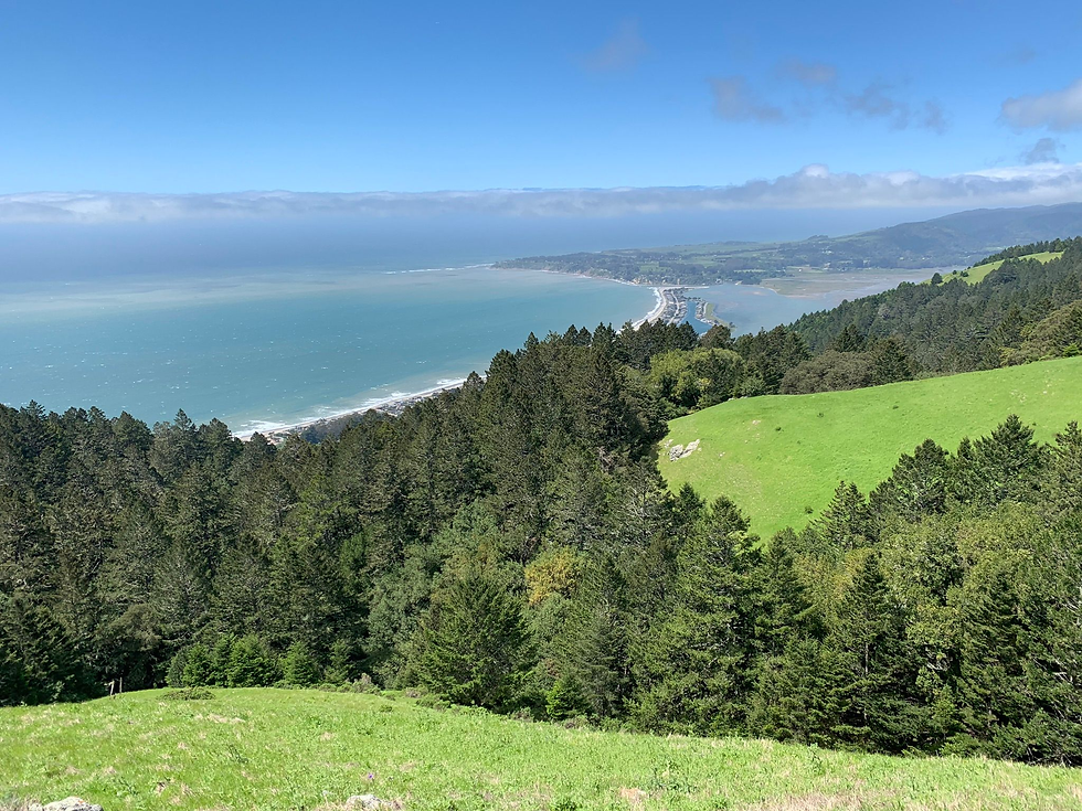
10 Best Hikes in the Bay Area
- GlobeSisters Team

- Nov 16, 2022
- 4 min read
Updated: Feb 10, 2023
The Bay Area is known for its natural beauty, and hiking is a great way to get outdoors and discover cities from a different perspective. These popular hikes range from easy strolls to a bit more difficult climbs. Here’s our list of hikes all around the Bay Area. (List is sorted from North to South of the Bay.)
Distance: 2.5 miles
Difficulty: Moderate
Located in Marin County, the Tomales Bay Trail is an easy 2.6-mile round trip walk through pasture land in where you might see cattle grazing. The trail crosses along a bluff featuring an incredible view of Tomales Bay. You’ll cross multiple terrains like meadows, ponds, and marshes. The easiest way to get to Tomales Bay Park is by car.
Distance: 11.7 miles roundtrip
Difficulty: Hard
If you are looking for something a bit more challenging, this hike is for you! This trail was rated a 4.5/5 on AllTrails with exquisite reviews on the scenic features such as the Marin Headlands and the Pacific Ocean. You’ll have the option to explore beaches and other historical sites along the way.
Distance: 1.2 miles
Difficulty: Easy
Tamalpais is a beautiful trail to immerse yourself in nature. We recommend going on a clear evening and watching the sunset. The Plank Walk Trail is an easy intro walk so if you want more of a challenge we recommend the Verna Dunshee loop. This trail features stunning views of San Francisco, Northern Marin, and the East Bay.
Distance: 2.2 miles
Difficulty: Easy
If you want to surround yourself with redwood groves, Muir Woods is a very different change of scenery from some of the others on our list. To get there you can drive or take a bus from downtown SF to Muir Woods National Monument. The most popular trails are the Main Trail (.5 miles), Hillside Trail (2 miles), and the Ben Johnson trail. The Ben Johnson hike is going to be the longest, but will definitely be worth it when you make it through the redwood groves and open up to a view of San Francisco.
Distance: 1.5 miles
Difficulty: Moderate
Listed on GlobeSisters ‘Things to do in the Bay Area, Fire Trails is a steep but rewarding hike. The best way to start the Berkeley Fire Trails is to access it at the top of Dwight Way, next to the UC Berkeley Clark Kerr Dorms. The first half of Fire Trails is a bit of a leg burner, but the views of Berkeley, Oakland, and San Francisco is well worth it! It doesn’t take long to reach the top, so you’ll quickly be rewarded for your efforts.
Difficulty: Hard
Mt. Diablo State Park has a lot of trails to offer with a range of difficulties. The most popular are Donner Canyon (moderate, 5.1 miles), Mount Diablo Grand Loop (hard, 6.2 miles), and Waterfalls of Mount Diablo Loop (hard, 7.9 miles).
Distance: 3.5 miles
Difficulty: Moderate
Located in San Francisco, Lands End is the perfect place to sightsee. Lands End has views of the Pacific Ocean, Golden Gate Bridge, Marin Headlands, and Sutro Baths. The trail is well-maintained and easy to navigate. Because it's a popular place, it can get a bit crowded on weekends. If you want to extend your journey to a full day of hiking, you can exit Lands End on the east side and go north to the trails in the Presidio.
Distance: 2.1 miles
Difficulty: Moderate
If you want panoramic views of San Francisco and the rest of the Bay Area, Twin Peaks is an iconic viewpoint in San Francisco. Twin Peaks weather can be unpredictable, so be sure to bring layers in case the heavy SF fog rolls in. There are several trails including the Creeks to Peaks 1.8-mile hike.
Distance: 2.4 miles
Difficulty: Moderate
Pedro Point is a popular spot for hiking, running, and looking at wildlife. This hike takes you along the coastline, connecting Linda Mar Beach and Pacifica. The views are amazing as you look out onto the expansive oceanside and the many ecosystems within this region. It can get pretty windy so it's always a good idea to layer up.
Difficulty: Moderate
Located in Palo Alto, the Stanford Dish and Windy Hill Preserve are both great places to visit. The Dish is a popular paved 3.6-mile loop, perfect for walking or running. Windy Hill has amazing views overlooking the Peninsula— a perfect place to watch the sunset!
Wherever you plan on going hiking, one helpful tool is AllTrails. The app shows you nearby trails, includes descriptions of the trails and can give you a sense of the trail’s condition (such as whether it’s muddy or rocky). It’s a great way to find the right hike for you.
Though this is a short list of local Bay Area hiking, we also recommend taking a trip to Tahoe or Yosemite. Both destinations are a 4-hour car ride from the Bay Area, but are definitely not something to be missed! If you are staying local, be sure to check out GlobeSisters’ guide to the greater Bay Area and other tips.


Comments